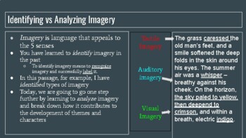
Imagery, the use of vivid or figurative language to represent objects, actions, or ideas, is a powerful tool in literature and other forms of media. It allows writers and creators to paint a picture in the reader's or viewer's mind, evoking emotions and helping them to better understand and relate to the work. When analyzing imagery, it is important to consider both the specific images being used and their overall effect on the piece.
One way to analyze imagery is to consider the specific objects or actions being described. Is the imagery concrete and specific, or is it more abstract and metaphorical? Concrete imagery uses detailed, sensory language to describe specific objects or actions, while abstract imagery uses figurative language to represent more abstract concepts or emotions. For example, a concrete image might be "the sun setting over the ocean, casting a golden glow across the water," while an abstract image might be "her heart was a tangled mess of knots." Both types of imagery can be effective, but it is important to consider how the specific images being used contribute to the overall tone or theme of the work.
Another aspect to consider when analyzing imagery is the effect it has on the reader or viewer. Does the imagery help to create a certain mood or atmosphere? Does it evoke specific emotions in the audience? Is it used to convey a particular message or theme? For example, dark and ominous imagery might be used to create a sense of foreboding or danger, while bright and vibrant imagery might be used to convey hope and joy. By examining the effect of the imagery on the audience, we can better understand its purpose and how it contributes to the overall meaning of the work.
Imagery can also be analyzed in terms of its symbolism. Symbols are objects or actions that represent something beyond themselves, often standing in for larger ideas or themes. For example, a rose might symbolize love or a white dove might symbolize peace. When analyzing imagery, it is important to consider whether the images being used have any symbolic significance and how they contribute to the overall meaning of the work.
In conclusion, analyzing imagery involves considering the specific images being used, the effect they have on the audience, and any symbolic significance they may have. By carefully examining the imagery in a work of literature or other form of media, we can gain a deeper understanding of its themes, mood, and overall meaning.
Image Analysis Software

Examine Imagery Imagery can be divided into different categories, according to which sense it appeals to. You'll inspect the image properties to see if you can identify the issue. For elevation data, the Bilinear resampling technique is preferred. It was a white one. It is a single seamless elevation raster and has been reprojected to the correct spatial reference. The layer is added to the map. Review the contents and folder organization and note how the source images and rasters are categorized and stored, especially in the DEM, DSM, Imagery, and ScannedMap subfolders.
About analyzing imagery and raster data—ArcMap
The project package contains the raster layers prepared to analyze overtourism in the town of Hallstatt. The X and Y fields update to 0. Such images can be readily displayed in ArcGIS Pro like any multiband raster dataset. There is no front yard, only four little elms the city planted by the curb. Due to the accurate georeference, the historical map appears well aligned with the aerial photo. Figurative language is a kind of rearrangement or unconventional way of saying things, and it is also another word for imagery. Traditional image analysis methods, where each processing step is applied to an image to produce a new dataset, can require significant computing power, take a long time to process, and produce unnecessary intermediate datasets that required additional storage space and data management.
Analyzing imagery using raster functions—Imagery Workflows

Saving the project saves the state of the layer as you have edited it, but only within this project. You will also analyze the impact of specific word choices on the meaning of this portion of the essay. Note: Some of the extents will be slightly different due to the different pixel sizes of the inputs. Now that you have preprocessed all of the layers, you'll clip them all to the same area of interest. In this module, you learned about three types of spatial reference issues that can occur and you learned how to fix them. You can even recognize an occasional tree. State Government Directorate Presidium, Department Presidium, Landhausplatz 1, 4021 Linz Telephone: +43 732 77 20-111 61 Fax: +43 732 77 20-21 16 21 Email: praes.
How to Analyze a Poem With Imagery

Due to the DRA setting, the stretch of the DSM is recomputed to show you more details. The pixel depth is 8 Bit, which means that a pixel can hold 256 different values. Note: Very often, ArcGIS Pro chooses the correct geographic transformation, but not always. By the end of this tutorial series, you should be able to explain how character development, setting, and plot interact in excerpts from this short story. If prompted, sign in to your ArcGIS account. Improve the symbology of the image In this section, you'll learn how to change the appearance of the raster image.
Prepare imagery and raster data for analysis

You'll keep Bilinear as the resampling type. The map zooms to the extent of the town and some of the surrounding forest and lake. Interrogating the images and pixel values There are additional tools in ArcMap to help you in your analysis of raster data, such as the Pixel Inspector tool , which is used to view an area of pixel values in your raster dataset, or the Swipe Layer tool , which is used to interactively reveal layers beneath the layer being swiped. First, you'll inspect the image properties. You also changed the appearance of the imagery and saved those choices to a layer file. In this section, you discovered that a raster had a valid spatial reference, but that it was different from the one chosen for the project, and you reprojected it to the preferred coordinate system.
