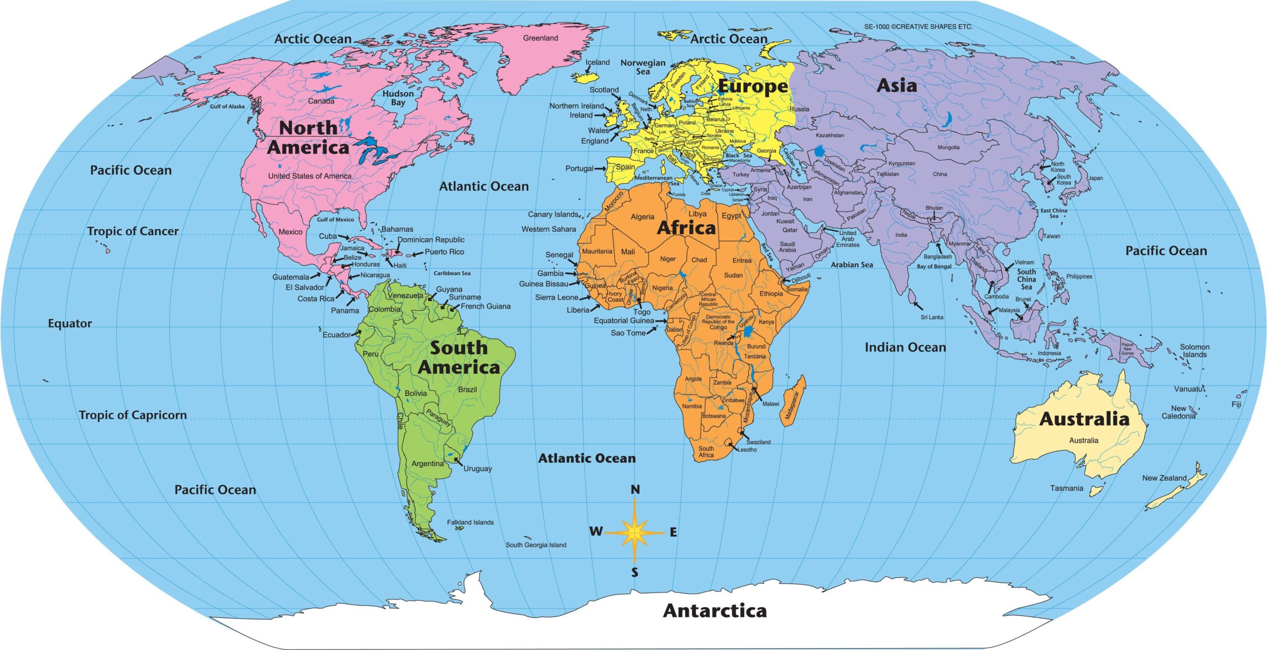
Maps are an essential tool in the study of geography. They are used to represent the Earth's surface and its features, including physical features such as mountains, rivers, and oceans, as well as human-made features such as cities, roads, and borders. Maps can be used to communicate information about a specific location or region, and they can be used to analyze and compare different areas of the world.
One of the primary uses of maps in geography is to understand the spatial relationships between different features on the Earth's surface. Maps allow us to visualize the location of physical and human-made features in relation to each other, which can help us understand the patterns and connections between different regions. For example, maps can be used to show how rivers and mountains influence the distribution of human populations, or how transportation networks connect different parts of the world.
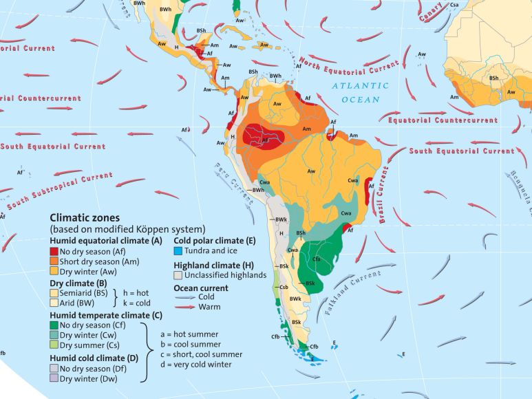
Maps are also used to study the Earth's physical features, including its landforms, vegetation, and climate. Physical maps show the topography of an area, including its mountains, valleys, and plains. Vegetation maps show the distribution of different types of vegetation, such as forests, grasslands, and deserts. Climate maps show the average temperature and precipitation patterns of an area. These types of maps can help geographers understand the natural environment of a region and how it has shaped the development of human settlements and activities.
In addition to their use in the study of physical geography, maps are also important tools for understanding human geography. Maps can be used to show the distribution of human populations and the locations of human settlements, such as cities and towns. They can also be used to show the transportation networks that connect different parts of the world, including roads, railways, and shipping routes. Human geography maps can help geographers understand how human activity has shaped the landscape and how different societies are connected to each other.
Another important use of maps in geography is to support decision-making and planning. Maps can be used to identify patterns and trends in the distribution of resources, populations, and other features. They can also be used to evaluate the potential impacts of different development projects or policies, such as the construction of a new highway or the implementation of a land-use plan. By visualizing the location and relationships of different features on the Earth's surface, maps can provide valuable insights into the complex systems that shape our world.
Overall, maps are essential tools for the study of geography. They allow us to understand the spatial relationships between different features on the Earth's surface, to study the physical and human characteristics of different regions, and to support decision-making and planning. By providing a visual representation of the Earth's surface and its features, maps help us better understand and navigate the world around us.


